Many people may not give much thought to the clouds in the sky, but understanding their different types can provide valuable insight into weather patterns and atmospheric conditions. As a result, it is important to have a basic understanding of the different types of clouds and their characteristics.
This guide will explore the four main types of clouds and gain a better understanding of their characteristics and roles in our atmosphere. Read on to learn more about these fascinating formations and their impact on our daily lives.
II. Understanding Cloud Formation
Before diving into the different types of clouds, it is important to have a basic understanding of how clouds form in the atmosphere. Clouds are formed when water vapor in the air condenses into tiny droplets or ice crystals. This usually happens when warm, moist air rises and cools down, causing the water vapor to reach its dew point. The dew point is the temperature at which water vapor begins to condense and form clouds.
There are several factors that can influence cloud formation, including air temperature, humidity levels, and air pressure. These variables determine the amount of moisture in the air and how quickly it will reach its dew point. For instance, warmer air can hold more water vapor compared to colder air. As a result, the higher the temperature, the more moisture the air can hold before reaching its dew point.
When clouds form, they can take on different shapes and sizes depending on the atmospheric conditions. This is where the four main types of clouds come into play.
III. Classification of Clouds
There are different classifications of clouds that are based on their altitude and appearance. The four main clouds people know are cirrus, cumulus, nimbus, and stratus, but there are also subtypes of these clouds that fall under each category. These classifications include:
A. High-Level Clouds (H1)
High-level clouds are located at altitudes of 16,500 to 45,000 feet (5,000 to 14,000 meters) and are mainly composed of ice crystals. These clouds usually have thin and wispy formations and can often be seen in various shapes. Some common types of high-level clouds include:
1. Cirrus clouds
Cirrus clouds are thin and wispy clouds that are usually formed at high altitudes. They have a feathery appearance and can be found in various shapes, such as curls, hooks, or feathers. These clouds are composed of ice crystals and indicate fair weather conditions. They form when moist air is carried upwards and freezes due to the low temperatures at high altitudes. Cirrus clouds are often associated with good weather, but their presence can also indicate a change in atmospheric conditions.
2. Cirrostratus clouds
Cirrostratus clouds, characterized by their thin and sheet-like appearance, gracefully stretch across vast expanses of the sky. Found at high altitudes, these clouds are composed of intricate ice crystals, delicately woven together. As nature’s artist, they often serve as harbingers, signaling the imminent arrival of a storm or the gentle touch of precipitation within the next 12 to 24 hours.
3. Cirrocumulus clouds
Cirrocumulus clouds are small, rounded clouds that often appear in rows or waves, creating a mesmerizing pattern across the sky. Found at high altitudes, these delicate clouds are composed of countless tiny ice crystals, reflecting the sunlight and casting a stunning glow. While their presence can indicate a shift in atmospheric conditions, such as the approach of a front, it’s important to note that cirrocumulus clouds do not necessarily herald rain. Their ethereal beauty adds an enchanting touch to the ever-changing tapestry of the heavens above.
B. Mid-Level Clouds (H2)
Mid-level clouds form between 6,500 to 23,000 feet (2,000 to 7,000 meters) and are mainly composed of water droplets. These clouds have a thicker appearance than high-level clouds and can often block out the sun. Some common types of mid-level clouds include:
1. Altostratus clouds
Altostratus clouds, characterized by their gray or blue-gray color, elegantly blanket expansive sections of the sky. These majestic cloud formations typically manifest at mid-level altitudes, offering a mesmerizing sight to behold. In addition to their aesthetic appeal, altostratus clouds possess the capacity to generate gentle precipitation, ranging from delicate drizzles to softly falling snowflakes. Observing these clouds can serve as a harbinger of an impending storm system, adding an element of anticipation to the atmospheric spectacle.
2. Altocumulus clouds
Altocumulus clouds are small, rounded clouds that usually appear in groups or layers, adding a beautiful touch to the sky. With their puffy appearance, they resemble cotton balls floating above us. These clouds can be seen in various shades of white or gray, creating a mesmerizing display. While altocumulus clouds are often associated with fair weather, their presence can also serve as a subtle indication of an approaching storm, adding an element of mystery and anticipation to the atmospheric canvas.
C. Low-Level Clouds (H3)
Low-level clouds form at altitudes of up to 6,500 feet (2,000 meters) and are mainly composed of water droplets. These clouds often have a dark or gray appearance and can produce light precipitation. Some common types of low-level clouds include:
1. Stratus clouds
Stratus clouds are low-lying, flat, and sheet-like clouds that typically envelop the entire sky in a continuous layer. With their smooth, uniform appearance, they often present a gray or dark hue, casting a somber ambiance. While stratus clouds may seem unassuming, they can occasionally bring forth light rain or drizzle, adding a touch of moisture to the air. Commonly associated with overcast weather, these clouds create a serene and tranquil atmosphere that blankets the landscape below.
2. Stratocumulus clouds
Stratocumulus clouds, characterized by their low-level altitude, display a distinctive puffy or lumpy structure. Appearing in rows or groups, these clouds may occasionally bring about light precipitation. Typically indicative of fair weather, their presence can also serve as a forewarning of an approaching storm, making them a fascinating element of the ever-changing atmospheric landscape.
3. Nimbostratus clouds
Nimbostratus clouds, with their characteristic thickness and darkness, can be observed as they blanket the entire sky, creating a mesmerizing sight. These clouds are known for their ability to generate continuous precipitation, whether it be gentle rain or delicate snowflakes, immersing the world below in a soothing and refreshing ambiance. Often associated with stormy weather, nimbostratus clouds evoke a sense of anticipation and wonder as they cast a veil of mystery over the horizon, creating a captivating scene that captures the imagination.
D. Vertical Clouds (H4)
Vertical clouds form at all levels of the atmosphere and have a vertical development rather than a horizontal one. These clouds can indicate unstable atmospheric conditions and may lead to severe weather events, such as thunderstorms or tornadoes. Some common types of vertical clouds include:
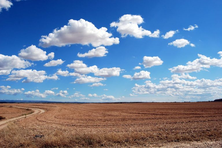
1. Cumulus clouds
Cumulus clouds, with their distinctive appearance, are characterized by their puffy and white nature. These clouds exhibit a flat base and rounded tops, giving them a unique shape that stands out in the sky. They can be found at various altitudes, ranging from low to high levels in the atmosphere. Not only are cumulus clouds visually appealing, but they also serve as indicators of fair weather conditions. Their presence often signifies clear skies and pleasant conditions, making them a welcome sight for those who enjoy spending time outdoors.
2. Cumulonimbus clouds
Cumulonimbus clouds, also known as thunderstorm clouds, are massive, towering formations that can reach impressive altitudes. With their dark and menacing appearance, they cast an ominous shadow over the sky. These formidable clouds are notorious for producing intense thunderstorms, torrential rain, and even hail, making them the most hazardous and volatile type of cloud. Their turbulent nature and capacity for severe weather phenomena make them a sight to behold and a force to be reckoned with in the ever-changing atmosphere.
IV. Visual Identification and Differentiation
As you become more familiar with the different types of clouds, you may find it helpful to have a visual guide or chart to assist in identifying them. However, there are also some key characteristics and visual cues that can help differentiate between the various cloud types.
High-level clouds, like cirrus and cirrostratus, usually have thin and wispy formations consisting of ice crystals at high altitudes. These delicate clouds often appear feather-like and can create beautiful patterns in the sky. On the other hand, mid-level clouds, like altostratus and altocumulus, are thicker and can block out the sun to some extent. They are composed of water droplets and can have a puffy or wavy appearance.
Moving lower in the atmosphere, we find low-level clouds, such as stratus and stratocumulus. These clouds are often associated with overcast or gray skies and may extend horizontally for long distances. The condensation of water vapor forms them and may produce light precipitation, like drizzle or light rain.
In addition to these horizontal cloud formations, there are also vertical clouds that indicate unstable atmospheric conditions. Cumulus clouds, for example, are characterized by their cauliflower-like shape and upward development. They are often seen on fair-weather days and are a sign of rising thermals. Cumulonimbus clouds, on the other hand, are towering and dark, with the potential to produce thunderstorms and severe weather events.
If you are interested in learning more about cloud identification, there are many resources available online, such as cloud charts and photographs. These resources can be used to practice identifying different types of clouds and become more familiar with their unique characteristics. Exploring the world of clouds can be a fascinating journey, unveiling the diverse and ever-changing nature of our atmosphere.
V. Implications of Clouds on Weather Patterns
As mentioned, understanding the different types of clouds can provide valuable insight into weather patterns and atmospheric conditions. By delving deeper into how these clouds form and their unique characteristics, we can enhance our ability to predict changes in the weather and prepare for any potential disruptions.
Weather forecasting relies heavily on comprehending the presence and behavior of clouds in the atmosphere. For instance, the presence of high-level clouds, such as cirrus clouds, often indicates fair weather conditions, while low-level clouds, like stratus clouds, may signal the approach of a storm. Additionally, the vertical development of clouds, such as towering cumulonimbus clouds, can serve as a warning sign for potential severe weather events.
Furthermore, closely observing changes in cloud formations can also assist us in tracking climate patterns and identifying long-term weather trends. As our climate continues to evolve, monitoring cloud behavior can provide valuable information about the state of our environment and its impact on weather patterns. By paying attention to shifts in cloud cover, thickness, and movement, we can gain a deeper understanding of the complex interplay between the atmosphere and the climate system.
In summary, the study of clouds goes beyond their aesthetic appeal. It is an indispensable tool for meteorologists and climatologists, helping us unravel the secrets of our ever-changing weather and climate.
VI. Impact of Clouds on Climate
Clouds, those ethereal entities in the Earth’s atmosphere, are not just a picturesque backdrop but an indispensable component for maintaining our planet’s energy balance. They perform a dual role, reflecting incoming solar radiation back into space, thereby helping to cool and stabilize the Earth. However, they also entrap outgoing infrared radiation from the Earth’s surface, thereby contributing to the infamous greenhouse effect.
With our climate in a state of flux, there is an ever-growing interest in comprehending the impact of climate change on clouds and the potential influence they may exert on future climate patterns. The study of cloud behavior yields invaluable insights into the intricate relationship between clouds and climate change. For instance, alterations in cloud formation and behavior can have a profound impact on the amount of solar radiation reflected back into space, which, in turn, can significantly influence global temperatures.
Moreover, clouds act as a feedback loop for climate change, further exacerbating its effects. As the Earth warms, more water vapor is evaporated into the atmosphere, leading to increased cloud formation. These additional clouds, in turn, intensify the entrapment of heat, resulting in further warming. By delving into this feedback loop, scientists can enhance their ability to predict and mitigate the far-reaching consequences of climate change.
VII. Conclusion
In conclusion, understanding the different types of clouds is essential for gaining insight into weather patterns, climate change, and our planet’s overall health. By familiarizing ourselves with their characteristics and behavior, we can make more accurate weather predictions and better prepare for potential disruptions. So next time you look up at the sky, take a moment to observe the different cloud formations and appreciate their role in our daily lives. And don’t forget to keep exploring and learning about these fascinating formations! Happy cloud-watching!